NW walk Day 6 (Friday) – Ben Stack (21km)
We had organised for Scott’s cousin to pick me up at 7:15am to take me down to Achfary (the estate/hamlet in between Ben Stack and Arkle) so I was up at 6am thismorning to pack everything into a daypack. This was particularly unpleasant as I hadn’t got home until 2am that morning! His cousin works at the estate so I could go down with her in the morning, walk all day then come home with her in the afternoon. We also dropped another couple of people off (that’s how things seem to work up here – if you’re going somewhere you often end up with a few passengers wanting to go to the same place!). One of them was a “pony boy” from one of the estates, who looked very smart, all dressed up in tweeds. Apparently pony boys use the ponies to bring home any deer that the stalkers shoot.

The Achfary estate office.
I had a choice of Ben Stack (the next hill on my original route) or Arkle, or I’d considered the possibility of a round trip to do both. Both hills were covered in cloud. Arkle’s looked slightly more permanent so I decided to go up Ben Stack. I thought I might go over it then follow my planned route (backwards) towards Kylesku then come back to Achfary along the track that the Cape Wrath Trail suggests. This was ~30km, and mostly track so should’ve been possible.
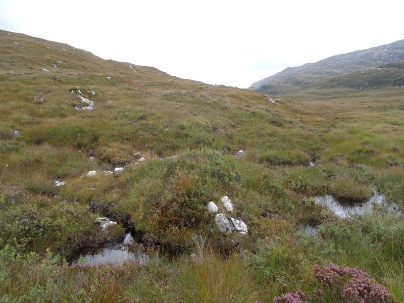
I set off, a short walk up the road then turn along a ‘track’ (bog) up towards Ben Stack. It was very boggy (the whole area, not just my track). Also, my legs were very tired . . . and I was very tired too!! It was a very long slog up the hill. One of my guidebooks had said “keep to the left of the rock spur” but I was seriously doubting that was the easiest way! I saw a bunch of deer on the way up too, and got some nice photos of them.

Deer, next to the big rocky spur I was supposed to keep left of. There are three in the photo – can you see them all?
Up and up and up I went (with a few bits of across and a few rests) then . . . oh, . . that’s the summit shelter! It was a bit anticlimactic really. The summit of Ben Stack is interesting though – it’s a dual ridge, with a dip in between.

The dual ridge on Ben Stack (summit shelter just visible on the far ridge)
The entire ridge was fully clouded so I sat behind the summit shelter for a bit and had some food. Then, the cloud on the far side (east) cleared, so I ran over there (down into the dip, back up onto the other ridge). Nope, it had covered over again. Then the other side (west) cleared! I ran back. Nope, covered again! This happened quite a few times until eventually enough of the cloud cleared, . . or I ended up on the right side at the right time to get some views.

Summit shelter and view SW

View to the NE (Loch Stack on right)
I continued northwest along the ridge, which got very narrow in some places. There was cloud below me and it was very windy . . . . a little bit scary! I was half crouching as I walked across some of the narrow exposed sections. Then I was off the ridge and into the descent. It was very steep, slippery and rocky. It was also still covered in cloud and very very windy in some places!!

Partway down the descent. Photo taken to try to indicate how crazily windy it was!
My original plan was to walk this hill in the opposite direction (NW to SE). This would definitely have been a better way to tackle it. The steep tricky rock section would’ve been quite fun to climb, with the long, gentle descent being an easy way to finish. Instead, I had a long slog to get up then a very tricky and unpleasant descent.
Once I got off the steep rocky bit onto the lower slopes I couldn’t really find which way to go. There was supposed to be a track to the base of the mountain but I couldn’t see it from where I was. I ended up getting stuck on top of an outcrop just before the track and having to backtrack and go around. When I did eventually walk up and find the track it was so obvious! This would’ve been another good thing about going the opposite way – it’s much easier to find a track junction aim for a mountain than leave a mountain and find the exact spot that a track peters out.
 Somewhere there (towards the right of the photo) is a path. Can you see it? I couldn’t. |
 The path is incredibly obvious at this end! |
I walked east towards the main road and had a look at the stepping stones (marked on my map) across the River Laxford near Stack Lodge.

Stepping stones across River Laxford. I’d been thinking about crossing here – glad I didn’t have to try. I don’t think I would’ve managed this one with dry feet!
I then turned back and went along the same track, past the base of Ben Stack this time. I had already decided that I wasn’t going to do my original route backwards (towards Kylesku then back to Achfary along the Cape Wrath Trail) – I was just too tired. Plus, my shoes were definitely not waterproof anymore! Instead I decided to have a very leisurely walk back around the base of Ben Stack through Strath Stack (a strath is like a glen, but wider . . . ie a valley). There was a signpost on the mainroad that advertised this walk. I followed the track to the far side of the hill then turned into the valley. For a signposted route, this turn was incredibly inconspicuous. There were no signs and the track I turned onto was barely visible! From here, it was not so much a track as a bog. I spent most of my time walking parallel to the path about 10 metres higher up the valley.
The “track” through Strath Stack (NW end). It is that muddy patch on the right of the photo.
In general though, this was a lovely walk. The scenery was beautiful and it was very peaceful. I was really loving the countryside and was thinking about how hard it would be to leave Scotland.

A lovely track (with drainage and everything) at the SE end of Strath Stack. And incredibly lovely, enjoyable walk through here.
Somewhere along the valley the track started up again, then I headed into a pine forest and back into Achfary. I still had an hour or so to kill until hometime so I walked down the main road (SE) for a little bit. Despite being the main road to Inverness, it was actually reasonably quiet. There were some large birds of prey wheeling and calling out of the ridge to the west –they may’ve been eagles, but they were too far away to get a good look.
There were some very interesting stepping stones across the bit between Loch More and Loch nan Ealachan (I tried to follow the path out to them but it turned into a marsh).
 Looking NW up Loch More at the stepping stones and tiny bridge. Arkle in the background, still crowned in clouds. |
 A close up of the stepping stones and bridge. |
I sat on a little stone pier for a while, taking photos and generally enjoying the scenery. Arkle, in particular, was looking stunning (still with its crown of clouds). I hadn’t really been a fan of this hill thismorning, but it has really grown on me throughout the day and is quite stunning. Here is my new favourite picture of Arkle!
I headed back to the estate, absolutely exhausted by this point and after a short wait (with a cup of tea and a seat in the estate office) we went back to Durness. I cleaned myself up then staggered over to the Smoo Cave Hotel for dinner. What a struggle! I was so tired, I barely made it there.


Ben Stack is quite steep.
NW walk Day 5 (Thursday) – Quinag (20km)
It was a dry night and the midges were mostly gone by morning. The campsite had been reasonably good. I packed up and headed across the bog, which was not too bad as it was starting to dry out. I was heading at a bit of an angle towards the road, thinking that the start point car park was further north but not entirely sure if I hadn’t missed it and gone too far north already. Shortly I saw people, the bridge and then the road signs.
Once I got there I filled my water bottle at the bridge (filtering the water, as it was a bit of a muddy stream) then headed up the path. I “hid” my pack off the track just pass the turn off to Spidean Conich (the southern ridge/peak). It was well hidden from the road side but pretty obvious to anyone coming back from the hill. It was the best I could do though with the flat terrain and low scrub.

My pack (the white dot on the left), a good path, carpark in the distance and Glas Bheinn in the background.
It was a reasonably good path but it seemed to take forever to get to the col. The col on Quinag is very low down (only about 580m, vs 800 for the peak) but there were still very nice views out to the west from here.

Views to the west from the col.
After having a good look off the edge I headed NE up to Sail Garbh. Sail Garbh is the highest of the three peaks and is a small quartzite cap on top of the main sandstone ridge. It was easy enough going up on the sandstone but much harder going on the quartzite. The change between the two rock types is so obvious!

Heading up to the Sail Garbh summit. See the change from pink sandstone to grey quartzite?
On the way there I came round a corner and saw a crazy old sheep – I’m not sure who looked more surprised, him or me!

Crazy old sheep! Hasn’t seen a shearer in a while.
The summit of Sail Garbh has a theodolite mount on it, as do quite a few of the peaks around here. I was very happy to be on the peak of my hill, and even happier at having a theodolite mount there (as well as loving geology, I’ve dabbled in old fashioned surveying. The thought of carrying an old theodolite up here doesn’t excite me though!).

Survey mount in summit shelter on Sail Garbh (Spidean Conich on the left, Suilven in background)
From here I headed further north, coming down off the summit and along the long sandstone ridge to the very end. Coming off the peak was a bit loose and slippery, but not too bad. Then it was sandstone pavement all the way to the end of the ridge. It was stunning. Awesome. Wow! I was so excited to be there! This was the ridge that I’d seen 2 years ago that had dragged me back here, and now here I was, standing on the very end of it! It was a pretty impressive end too. A lot of places look steep from a distance but up close are not so bad. Not this one. The edges of this ridge were almost sheer all the way down to ground level. I walked around for a while with my arms out like an aeroplane, marvelling in the feeling of the hill and air and just being there.

The view to the north off the very abrupt edge at the end of the Sail Garbh ridge.
I simply can’t explain how amazing it felt to be standing up there.
There were also some birds nesting just off the edge near the end of the ridge, which was pretty cool.
I was going to get a small piece of sandstone from the end of the ridge and a small piece of quartzite from the summit, but I completely forgot in all the excitement. It’s pretty amazing for me to come home from a holiday without any pieces of rock but after I didn’t have rocks from here (my favourite ridge on my favourite hill) it just seemed silly to collect any from anywhere else!

Looking back at the summit from the end of the Sail Garbh ridge, along easy walking sandstone.
After soaking up as much of the atmosphere, and view, as I could, I headed back over the summit then onto the Sail Ghorm ridge (the north western one). It was a really long way out to the end of Sail Ghorm. Lots of ups and downs, narrow ridges, chimneys and buttresses. Amazing views. I went all the way to the end of the ridge again. Again it was awesome. I was very happy.

Rocky formations and view south-west partway along Sail Ghorm ridge.

Looking back at Sail Garbh from Sail Ghorm. Spidean Conich can be seen poking over the top in the background. All the lumps and bumps to the right of this are the Sail Ghorm ridge I’ve just walked along (except the big one immediately to the right, which I went around!).
From here I was going across to Spidean Conich. I ran some of the way back, partly through sheer exuberance and partly to make up time (I was getting picked up at the base in the early arvo). The path back to the col actually drops down even lower and then comes back up. I wasn’t interested in doing that so ended up scampering around the side of the hill on a goat track, across some scree slopes then straight down the edge! I was getting pretty good at this! (although I had jammed my ankles several times already today!)

The hillside I scrambled around on the right (across the scree and probably just below that lower dark patch). Spidean Conich looking fairly unassailable although you can just see the path snaking up the far edge. Suilven in the background.
Across the col, admiring the views again, then up the apparently unassailable Spidean Conich. It was not as bad as it looked, although there were lots of very high ‘steps’ – so high that I had to put my knee on one and lever myself up because my little legs were too short to get my foot up onto it! Up I went, all the way to the top. Spidean Conich is primarily quartzite so it was reasonably tricky walking. While it was a pretty cool climb up, this was the least impressive summit, partly because it was so wide and partly because I’d seen so many amazing views already today!

The final rise up to Spidean Conich. Looks impossible, was certainly interesting!
After the summit it turned into a big boulder field for the descent, similar to Breabag’s ascent, wide and semi directionless. It was very difficult at first, although eased off into grass and rock or mostly flat (sloped) quartzite pavement. It actually looked like there was a small patch of sandstone in there too?!?

Boulder field and quartzite pavement down the expansive, wide flank of Spidean Conich (looking east).
Towards the bottom the quartzite pavement became interspersed with bog. I followed the pavement strips too far, missing the path back to the main track (where I’d started). Once I realised this I cut back to the north and soon got back to the path. I’d seen signs on the way in asking people to “please use the new path to preserve the fragile heather and bog”, so I was keen to follow their request. Besides, walking through bogs sucks (no pun intended)!

The new path to Spidean Conich. It is lovely, very obvious and was definitely worth backtracking to find!
It was an easy walk back from there then back to the road, with a slight detour to retrieve my pack. I was back right on time . . . about 10 minutes before I was scheduled to be picked up at 2pm. Then it was off home to Durness with a big smile on my face!
Breabag had been really good yesterday and I wasn’t sure if Quinag would be able to top that. Oh it did though. She was amazing. Even better than I thought it would be. I love that hill!
I had planned to make dinner (homemade pasta) with Scott’s sister that night so once I’d got home and showered I headed round to her place. We put the kids to bed, opened a bottle of wine (we needed the bottles as rolling pins . . . at least that’s our excuse!) and made an amazing creamy salmon pasta. Yum!! Her partner was home and we had a great evening chatting, eating and drinking. Scott was working, but came round afterwards to try the pasta. Some small payment for driving me around all week! You can see some more photos of Quinag, and our pasta making effort here.
I saw, and talked to, a lot of people on top of the hill today. I talked to one guy twice (while I was going out and then back from Sail Ghorm), who had camped up here last night (what?!?!?! – he said luckily it didn’t get windy so he was fine) and was heading to Suileag bothy for tonight (what?!?!?! that is miles away! – he said he’d done the walk before, it was mostly track . . .but crappy, boggy track). We shared our enthusiasm and love of the hill. I spoke to an older couple also while coming back off Sail Ghorm and told them that going out to the end of the ridge on Sail Garbh was amazing, and not so difficult, and they said they might give it a go (at first they thought going out there was a crazy idea). On the way to Spidean Conich I saw a German Shorthaired Pointer (dog) swimming in the lochan up there. His owner was just descending from the peak (which I struggled to get up, but apparently the dog had no trouble coming down!). He said the dog loves heights and water so he is in heaven up here. I also saw at least 8 other people up there. Just before I got back to the carpark I also helped a young couple who were trying to find the Eas a Chulaiin waterfall by telling them how to get to it and showing them my map and guidebook (the little one I got in Inverness).

Man and his dog coming off the middle lump up to Spidean Conich.


NW walk Day 4 (Wednesday) – Breabag (27.2km)
I emerged from my tent to find that the midges had got up before me. It is the first time they’ve been really bad in the morning and I didn’t put my headnet on so got eaten a fair bit while packing up my tent.
The road walk up to the old cannery at the start of the Breabag walk was fine, with very little traffic at this time of morning. There was a car parked in the Parking bay near my campsite, with someone asleep inside! There was also a campervan parked a bit further down the road so this was obviously a popular place to stop last night. The stalking information sign at the cannery said they were stalking on the 17-23 August (a few weeks ago), so I should be fine to walk through (I had tried to check all stalking information before I left but hadn’t been able to find any for this area).
I walked up the valley diligently reading my Rock Trails guide to make sure that I saw all the attractions on the way. This area is limestone with the “attractions” being mainly the river (Allt nan Uamh) disappearing and reappearing along the course of the river. There are a number of springs, sometimes on the edge of the valley, and sometimes right in the middle. The weather had been good for this section of the walk, with a mixture of wet and dry. Recent rain meant that the springs were running well, but the dry summer meant that the water table was low so the river still disappeared a lot in between them. (This is what I think anyway, . . it may be completely incorrect reasoning)

The river (Allt nan Uamh) is actually that dry bed up the right hand side. The water on the left comes from the spring (see how it stops at the wall)

A large spring (not running) in the centre of the valley. Also dry river bed showing behind it.
A short way along the valley I went part way up the southern wall to visit the Bones Cave. This is an area of Special Scientific Interest and is called the Bones Cave because of the number of ancient animal bones in, some naturally occurring and some evidence of humans. There are quite a few caves, but no big accessible network so not especially ‘scenic’. I took a bunch of photos, including one which very closely mimics one from my Rock Trails book!

View out of one of the Bone Caves, looking at the opposite ridge (Beinn nan Cnaimhseag?)
From the Bones Cave it was back down to the valley floor (seeing some ‘pipe rock’ on the way – this is fossilised remains of worm castings) and following the still disappearing and reappearing river. It was much further than I had expected from here to the start of the hill proper. On the way were a series of waterfalls (all described in my Rock Trails book). The first big one, it said “you can’t walk up next to the waterfall but it’s worth seeing, so go up to the base and see it, then backtrack a little and go up the lefthand side of the valley”. I went and saw the base of the waterfall . . . but of course once I was there I wasn’t interested in backtracking all that way! The right hand side of the valley looked climbable right here, so up I went! I must admit, it was only just climbable, and there were a few wobbly moments (bear in mind I had a full camping pack on at this point too!).

The first main waterfall (I climbed up slightly off picture to the right).
A bit after this was the second interesting waterfall, this one being more of a water slide, with tilted layers of rock.

The “waterslide”.
After this I was into the quartzite. Quartzite (sedimentary, not metamorphic) is basically sand that has been solidified into rocks. When it breaks apart it does so firstly into quite sharp, angular blocks. Then, when it erodes further it basically turns back into sand. It is very hard and provides very little soil for plants so is quite a barren landscape. At least this means there is less water and bog . . . although when it does get wet it gets very slippery.
The walk up Breabag is not particularly steep but is very very long and not easy. There is lots of loose rock (that moves when you stand on it) and thin layers of slippery mud (that slide when you stand on it). Some bits actually had a covering of grass, which made things a lot easier.
There were a lot of deer on the way up and as deer are still a novelty for me, I took a LOT of photos of them! I think I actually chased the same herd of deer across the entire hill today as I kept seeing them at different parts of the walk.

Deer (top right) and typical terrain on the way up to the top of Breabag.
The final approach to the summit is almost flat, but again difficult. Almost completely barren, loose rock. The actual summit would be indistinguishable except for the large cairn/summit shelter there. The views from the summit were pretty good, with no clouds. It was a bit hazy, so visibility was reduced, and the photos aren’t stunning, but it was a lot better than I’d had from Suilven yesterday so I was happy!

Views from the summit to the west – Suilven is the double peaked one in the middle, Canisp is to its right. Quinag is the large multipeaked ridge on the right behind the loch.
I also saw some ptarmigan up here (I’d never seen one before, but they looked like what I thought a ptarmigan would look like, and I looked them up when I got home to confirm), and something that may’ve been a hare. It was bigger than a rabbit but still had a white tail (no photo, it was too fast!).

Can you see the ptarmigan? And typical summit terrain on Breabag.
My book suggested walking back along the eastern edge of the hill. Breabag is a bit of a one sided hill – the side that I’d come up was a very long, gentle (by Scottish standards) incline all the way along, with just a few outcrops. The eastern side, in contrast, was steep corries – circular bowls carved out by glaciers. This was definitely worth seeing. Wow! There were clouds floating up out of the corrie, obscuring the view but it was still very impressive.

Fog swirling out of the corrie.
A bit later on the clouds cleared so I was able to get some decent photos of the corrie and the views to the east. The corrie walls were pretty steep but it actually looked like some parts might’ve been possible to walk up (I was getting a better feel for the landscape by now and what walking conditions would be like).

Better views of the corrie wall, and valley with the River Oykel.
I now had a long walk along the top of Breabag to the northern end. There was no track and lots of loose rock and false summits. It was a bit of a gamble which way to go but I think I picked a pretty good path. At one point there was a huge split in the rock all the way across the ridge! Luckily it was not too deep and there was a broken bit in the middle that I could climb up. I wonder now if someone broke this bit deliberately to make it easier to get up, or if it is just there naturally.
 Looking left . . . |
 The one non-sheer section of the wall in front. |
 Looking right . . . |
There was also another section that had part of a stone wall built along the edge of the corrie.
 Looking east, see the wall on either side of the edge? |
 A close up on the right hand wall. |
At the northern end of the ridge I had to drop down into the Traligill Valley. I had researched this section quite thoroughly as it was quite steep, with lots of outcrops (cliffs). I had to go to the east a bit to get down to the valley before turning back to the west. Looking from a distance, the drop into the valley looked like it would be very steep and difficult. As it was, I followed my planned route on the map and then . . . . suddenly I was in the valley. No difficulties at all! In hindsight it may’ve been easier, and slightly shorter, on another route not as far east as I’d gone, but not having been there before I was very happy with the route I chose. I was also very excited because there was a beautiful track along the valley! Finding tracks where they’re supposed to be is exciting enough . . . finding one that’s not even marked on the map is amazing!!
This was quite a long walk, always with a little doubt about whether I was going the right, or best, way. There was always a chance I’d end up walking into some cliffs, or unclimbable rocks and have to backtrack a lot. That said, this was a very rewarding part of my walks . . . and that is probably the reason why.
The river valley (“follow the river”) was a very easy walk until suddenly the river dropped off the edge into a steep gully! Luckily the track kept going for a while, higher on the ridge. When that disappeared (Scottish tracks just do that) it was crosscountry again through bogs. Yay. I also saw a sinkhole (this happens in limestone, and I’d seen evidence of it in the aerial photos of the area) so was a bit more careful than normal while tromping through bogs.

A sinkhole in the Traligill valley (looking straight down on it probably ~0.5 x 1.5m)
I got back to the river (Allt a Bhealaich), which was also disappearing and reappearing . . . . until at one point it just disappeared completely. There wasn’t even a dried riverbed to follow! I thought I must’ve missed a turn but, nope, I checked the map and the river just ends!
Luckily shortly after this I found a track again. And, wow, it was a real track, with stone gaps to allow water to flow (love those things)! I was just getting excited about this when I saw some other people and the turn off to some more caves. One cave opens up into an underground river! Not a trickle seeping through the ground but the entire river flowing underground! There was nothing on the surface anywhere near here. I’m guessing that’s where the Allt a Bhealaich ended up.

The main cave entrance in the Traligill valley.

A close up panorama – see the water rushing through.
As I was coming out of the cave, a guy walked past. He asked if I was OK. Maybe he thought I’d slipped into the cave? Or maybe I just looked a little crazy?! They (there was a woman too) started following the track back to the main road, so I looked around the other caves then followed them.
The track, then road, gave a lovely scenic walk back to Inchnadamph. I was quite indignant about seeing a new house (complete with round turrets) on the hillside which was not marked on my map! Yes, my maps are that detailed that each house is marked!!

Following two people (who looked a bit like my parents in the 70s) down a good track towards Inchnadamph. See the new house (distance) with turrets, and Quinag in the background.
On the way out I saw another stalking sign. This one said that they were stalking this week. Oops! Obviously the sign I saw at the start of the walk hadn’t been updated.
I took a slight detour south to the Inchnadamph Hotel, thinking a pint would be nice, but it didn’t look open so I didn’t try. I’m glad I didn’t have to use this as my resupply point on the original walk! I read some signs about geology in the area then headed up the road (I had learnt that road walking was preferable to cross country across hills!). On the way I stopped at a plaque for a geologist (so excited to see something turning geologists into heroes!), at Calda House and at the signs for Ardvreck Castle (I didn’t go to the castle as I went last time I was here). I also saw a bunch of sheep walking up the road, including one who decided to sit down in the middle of the road and have a rest. I kept hearing cars braking suddenly and honking their horn, but it didn’t care! A jet also screamed through at about 500m, judging from the way it went between the hills rather than over them!
Just after Ardvreck Castle I turned off onto the side road to Achmore Farm. The track continued past the farm and was OK for about another kilometre before it turned into that worst kind of Scottish track: the bog! At this point the track actually becomes worse to walk on than the surrounding countryside. I walked parallel to the track for a while, then decided to just make a beeline for the carpark near Quinag, as much as you can beeline in bogs and lumpy hills! I saw a few sinkhole like things around here too so was being careful.

A Scottish track, aka bog!
I ended up finding a campsite a few hundred metres off the road, in view of Quinag and less than 1km from the carpark marking the start of the Quinag walk. It was reasonably flat, not too lumpy and not too boggy so decided to stop here rather than risk not finding anything else suitable. It was quite good, except for the bugs! I got eaten by midges AGAIN, mistakenly thinking that I could set my tent up quickly enough and electing to not put my headnet on! This means I got eaten at both ends of today – I would be so lumpy and itchy in a couple of days! Also tried using mum’s Avon insect repellent, which didn’t help at all!
The midges kept me locked inside and I’d pitched my tent tail into the wind which unfortunately meant I couldn’t look out my front door towards Quinag. Still, I was very happy to be sitting (and sleeping) so close to my mountain. I was hungry tonight and couldn’t be bothered waiting for my past to rehydrate fully, but it still tasted OK (just a little crunchy!). I was also loving my Romneys Extra Strong Mint Cake, and chocolate, for dessert! I was still not filtering my water but was at least selective at where I took it from: some directly from one of the main spring (Fuaran Allt nan Uamh), and some from a tiny lochan right at the top of Breabag. No sign of getting sick either! I’d also decided by today that my shoes weren’t waterproof anymore.
Today was a fantastic day. I saw some amazing views, conquered some difficult terrain, found my own path and enjoyed the whole thing. Not that some bits weren’t still very hard work! I also may’ve been going slightly crazy from spending too much time on my own. Here are some of the random thoughts I wrote down this evening:
There is so much water in this country I’m surprised its inhabitants don’t have webbed feet and gills!
I like my tent. I like being in my tent. Maybe something about when I’m here I’ve stopped for the day and I’m safe from midges and rain and anything else. I don’t need to do anything. It’s my own little world.
I feel like maybe 10 days of this would’ve been too much. I feel like I’m already going a bit kooky after 2 out here. Plus, it’s REALLY hard. 10 days would really wear me down. I’m also, while enjoying being here in my tent and living this life, also really looking forward to being picked up. Partly so I don’t have to walk/work anymore. Partly because I’m looking forward to seeing people (which wouldn’t have been the case originally).


Yes, I know, I blew my photo allowance again today, but I thought I did pretty well given that I took 230 photos today (vs my usual ~100)! There are also a couple more lovely photos of this walk here.
NW walk Day 3 (Tuesday) – Suilven (25.8km)
It was a very early start thismorning to get ready to leave by 6:30 so Scott could drop me off and get home in time for work. He did get back in time, but only just . . . not helped by me feeling car sick on the way there and the fact that I had glossed over the fact that I wanted to go to Inverkirkaig, rather than Lochinver . . . . not realising that the extra 5km to Inverkirkaig would take so long due to the incredibly narrow, incredibly windy, incredibly hilly road!
I set off along the track to the Falls of Kirkaig just before 8am. It was a lovely walk along the rushing River Kirkaig, through pretty forest, only marred by the fact that the midges were out and about. A little way along the track I passed a fisherman coming back the other way. I was quite surprised – it was still very early in the morning and he’d already been out, done his fishing and was coming home.

Good path along the River Kirkaig.
The walk to the falls was very nice. It was a good track, only a little bit muddy in sections, and the forest opened up into heather and bracken moors, getting rid of the midges and giving good views of the river and countryside.The ground was quite rocky, typical gneiss countryside, with the river cutting a very steep valley through it. I also had some good views of Stac Pollaidh, and my first glimpses of Suilven.

A (zoomed) view of Stac Pollaidh. I think I got to that lower flat bit towards the left of the middle (but am not sure because I couldn’t really see anything!)

An early view of Suilven, being gently crowned by clouds.
The final bit of path down to the falls was very steep (as the guide book I’d picked up in Inverness said) but not too difficult. I stopped on a ledge a couple of metres above the base of the falls and was very surprised to see a fishing rod poking over the top! I thought it must’ve washed down the river during a flood and somehow got stuck here. Then I heard voices! I very quietly peered over the edge and saw two guys there, eating sandwiches! I didn’t want to interrupt them so crept back away from the edge, took some photos then quietly climbed back up the path away from the falls.

Falls of Kirkaig (with fishing rod!)
I continued along the path which goes to the southern side of Suilven. It got progressively more boggy as it went along. I went almost to the neck on Fionn Loch, despite my guidebook suggesting I cut across the top. I think that would’ve been better, but it was nice to see a bit more of the loch and this let me check out the start of the River Kirkaig, where I’d considered trying to cross. It probably wouldn’t have been a good idea!

Kirkaig River where it exits Fionn Loch. I was thinking about trying to cross here . . . glad I changed my mind!
Walking along the northern side of the loch, the path just got worse. There were whole sections that were completely impassable that I had to detour around. This is also where I sunk (see here). New lesson in bogs: black mud with gravel on top is NOT sound.
I could see Suilven quite clearly at this point. It looked huge and unassailable, but I thought I could just see a path up.
I wanted to walk a bit further up Fionn Loch to the end where I’d planned to cross the Uidh Fhearna (coming from Stac Pollaidh) to see if it would’ve been possible. It was about 1km further, difficult walking with an almost non-existent path (I couldn’t see it anyway). Plus, it was almost midday, I still had a long way to go and I was getting a bit tired already. (I had also decided by this point that starting a long walk after a late night and lots of beers is NOT a great idea!)
So, I turned north and started up what might’ve been a track to the base of Suilven. It was quite an overcast day – great for walking, but not so good for hill climbing. The top of Suilven was only just free of cloud at this point. Up I went, stopping before the really steep bit for a rest and half of my lunch.

Looking up towards Suilven from the south. Somewhere here (in the foreground) is a path.
From here there was no path. Or 10 paths, depending on which way you look at it. It was basically a scree slope with a number of stream run-offs that you could clamber up, but it was all very loose and slippery. Suilven (like most hills in this area) is sandstone so is being eroded quite rapidly into loose dirt. In a few (hundred) years it will probably lose its lovely smooth rounded top and look a lot like Stac Pollaidh.
Eventually I reached the col and walked up to the wall that very strangely straddles the top of the ridge. I propped my pack up against the wall and headed up to the summit without it. I didn’t take a photo of the wall, but I’ve found a couple from other people (they don’t count as part of my picture allowance!). I also didn’t take my GPS logger out of my pack, so it only shows my track going to the wall. Clearly I wasn’t thinking very well at this point!

Someone else’s photo of the stone wall across Suilven’s ridge (from: http://hawkins.cx/gallery/main.php/v/scotland_june2008/IMG_1346.JPG.html)
Another sign that I wasn’t thinking too clearly was that I headed off to the summit with only my camera. No food, water, jacket, map or compass! The wind had picked up (being so high) and the cloud was now all over the summit and all the way down to the col. Even though there would be no views I had decided to go to the summit anyway. It seemed stupid to ‘almost go to the top of the hill’!

More what the wall looked like when I was there (minus two people and a dog) (from: http://www.songofthepaddle.co.uk/forum/showthread.php?16859-Five-do-7-Lochs-1-Mountain-amp-4-Portages-in-10-days!)
There were some very narrow bits along the walk to the summit. It was a bit windy, but not too bad in most parts, and visibility was OK (in the immediate vicinity – it was completely white beyond that). The summit was a long way off, with 3 or 4 minor ups and downs on the way. I was getting a bit worried about not bringing anything with me! In the end it was all OK . . . I just couldn’t stop too long or I’d get cold!

One of the very narrow (and also muddy and slippery) sections on the ridge going towards Suilven’s summit.
Coming back towards the wall I heard voices and came across a young American couple who’d come up from the north side and were going back down the south side. They looked like they did this sort of thing a lot. They were staying in Lochinver (I think) and said that on previous days they had actually been able to see people on top of Suilven from there (as tiny moving dots). Obviously they were a bit disappointed in the cloud cover today! I warned them about the scree, and the bog at the bottom, and they said the north side was much the same. I felt pretty sorry for them after descending because if they thought the north side was bad, they were in for a rude awakening on the southern trip! The descent of the north side was actually not too bad, but still pretty tough just because it was long. The tracks at the bottom were also quite good. Still a bit boggy but nothing like what I’d already been through.
I saw another lady (European) heading up towards the hill and had a quick chat to her. She may’ve been lucky because when I looked back about half an hour later the cloud had cleared from the summit. I was back onto proper tracks now, roads even for the first part, along a series of lochs.

An impressive bridge and proper road at the bottom of Suilven (across Abhainn na Clach Airigh?)
It was all pretty good walking except where I lost the track at the end of Loch na Gainimh and ended up cross country through some boggy grass and heather for a while.

A more modest (but still lovely) path along Allt a Ghlinne Dhorcha, looking back at Loch na Gainimh and Suilven
My navigation was all good (with lots of checking to make sure I was going the right way). The river crossing at the start of Lochan Fada was a long series of small stepping stones which I managed with dry feet. I also filled my water bottles here. I didn’t bother filtering it – clearly hadn’t learnt my lesson from my previous walks!

The stepping stone crossing where Allt a Ghlinne Dhorcha joings Lochan Fada. Safely negotiated with dry feet!
I had a short section of cross country navigation to finish the day and did a really good job of it. The track I was on continued south to near Elphin, whereas I wanted to go east to the top of little Loch Awe (I say little because there is a much bigger Loch Awe elsewhere in Scotland). I had chosen to come a little way south then cut between the two Cnoc an Leathaid hills (Bhuide and Bhig). This kept me on a track as long as possible and offered very easy navigation (easy to aim for the saddle between two peaks then follow a fence line up to Loch Awe). I was very happy with both my route selection and my navigation on this section. That said, navigation in Scotland is quite easy in this countryside and clear weather. You can see everything, for quite a distance and hills/lochs are often quite distinctive. It’s a big change from trying to navigate in dense forest on rolling hills in Western Australia!

The low spot between the Cnoc an Leathaids, from where I left the path.
I was also very impressed with my bog traverse here. The Cnoc an Leathaids were quite boggy (not just wet and squelchy but the big black hole type boggy) and I picked my way around them reasonably efficiently and effectively. That’s my opinion as a novice outsider anyway!!

Looking down from between the Cnoc an Leathaids to where I was going (left hand end of the loch, Loch Awe). The black maze on the right is bog. The grey hill in the background on the right is Breabag (tomorrow’s destination).
The slope down to Loch Awe was a bit tough – covered in thick, long grass. I had picked this route to utilise the footbridges across the rivers (Allt Mhic Mhurchaidh Gheir and River Loanan). Sadly the first footbridge had been washed aside! I tried to cross on some rocks, which went quite well until the biggest, stable-est looking rock tipped, dumping that foot in the water! At least I didn’t have too far to go with a wet foot.

The footbridge over Allt Mhic Mhurchaidh Gheir. Not much good to me!

Where I did end up crossing Allt Mhic Mhurchaidh Gheir. I think that concrete block used to be one of the bridge foundations! I got across the difficult looking bit safely, it was one of those big rocks that was my undoing.
The second bridge was fine.
I walked up to the road, to a Parking place, and decided to camp near here so I could tackle the 2.5km of roadwalk to the start of the next walk in the morning when there would be less traffic. I was also a bit tired so didn’t want to be wandering along the road trying to find a campsite. I went down a path to a ford across the River Loanan and found a good enough spot to camp nearby. It was reasonably close to the road (and in sight) but was down a hill so not too obvious. The ground was lumpy and tussocky so not great for pegs, or the tent floor. I found when I was setting up that I’d lost one of my carbon stakes, either here, or probably at my last pitch, before Stac Pollaidh. Not a problem as I had spares, but a bit disappointing still as I’d managed to not lose anything so far.
I also discovered at this point that I’d been particularly lazy (or scatterbrained) when I got to Durness after bailing out of my walk. I had just dumped all my gear in the corner of the room so everything was still wet! I should’ve unpacked and dried everything. Silly, bad me.
As it was, I pitched the inner and lay the fly out on the ground to give them a chance to dry, then mixed my dinner and rinsed off my gaiters, pants and shoes (still filthy from the bog incident thismorning). I finished pitching the tent (definitely tail into the wind this time in case the weather turned again!), hung my gear out to dry and retired into my tent.

Drying my gear since I was a very bad hiker and didn’t unpack properly after the last hike!
My dinner (pasta this time) had rehydrated properly (45 minutes, with cold water but in my pocket to warm it a little) and was surprisingly good. I settled in and read my book for a while – I had brought my Rock Trails book on this one since it was a shorter walk so less weight critical, and felt a bit like a tourist!
All in all, today had been a good day. I was reasonably happy and very much enjoying being in my tent again. Hopefully the clouds would lift tomorrow as Breabag was apparently a very featureless summit and difficult to navigate with cloud cover. Also, obviously the views are much better without clouds too!


Elevation for the pink line above. As you can see, Suilven is quite steep! This is without the ridge/summit section though.
And, I’ve exceeded my photo allowance for today, but I don’t care! I cut out everything I could but these all seemed essential to tell you the story.
Durness (Sunday – Monday)
Sunday started with a leisurely sleep in, complete with book reading, then some decision making about how I would continue my walking.
We decided that Scott would drop me down at Inverkirkaig early on Tuesday morning so I could pick up my walking almost where I left off. I would walk from there to Suilven, missing the large cross country section and two river crossings between Stac Pollaidh and Suilven but otherwise putting me back on track. I would then do 3 days of my original planned walk – Suilven to Breabag, then to Quinag. Scott would pick me up on Thursday afternoon at Quinag. My original plan for Quinag was to go up the southern ridge, walk all the ridges and then try to descend in between the two northern ridges. This descent was entirely unproven and not recommended anywhere. Ending the walk here allowed me to tackle Quinag through the more conventional route instead (up the middle of the corrie from the east, over the ridges then down the southern ridge). It also allowed me to leave my pack at the bottom of Quinag instead of carrying it up and over.
The rest of Sunday consisted of lunch at the Oasis (pub), then a walk with Scott’s dogs (or his parents’ dogs, depending on who you ask!). After a short walk on the beach for both dogs, Scott then dropped River and I out at Faraid Head with the instructions to walk down the beach, across the head then follow the beach back to town. Kyle is too old for long walks now, so didn’t get to come.

River kindly posing next to my shoes (walking barefoot on the sand)
River and I walked down the beach on the western side of the head, then cut across the top, then instead of finding beach, found lots of cliffs! We eventually went down to some beach but then got blocked by cliffs again and had to climb back up (River wasn’t too keen on this bit!). We then criss-crossed across the top of the head through waist high grass for several hours attempting to either find the beach that I was supposed to walk back along or find a way back to where we’d started without following the road. I eventually decided that “walk back along the beach” was not really an appropriate instruction and that I would have to go back the way I’d come. Not wanting to follow the road meant that it took us ages to get back, at which point both of us were quite thirsty. I found a small stream in a cow paddock and encouraged River to have a drink. Sadly it was very boggy and he promptly sank up to his belly then just stood there calmly looking at me as if to say “well, it was your stupid idea, you’d better get me out of here”. Luckily I could just reach him from solid ground so I pulled him out then had to take him back down to the beach to wash him off before returning him home!

The huge stunning expanse of beach on the western side of Faraid Head (along the Kyle of Durness)

More huge expanse of beach, and stunning blue skies (yes, I bailed out of my walk yesterday due to bad weather, . . . but that was 150km away!)

Looking north on Faraid Head towards the military facility (left) and the high point (right), which I didn’t walk to!

Looking north, near where River and I went down to a small patch of beach.

River, kindly posing again. See the cliffs on the left . . . that is where I was trying to “walk back along the beach”!
On Monday Scott was going out for the day so he suggested I go and visit his sister. Yep, sure . . . I’ve met her once for about five minutes . . . sure, I’ll just go and drop in! It turned out I had nothing to worry about. I ended up staying there all day, chatting to her and her partner and playing with the kids. I also got to meet various other family members when they dropped in throughout the day!
That evening I packed my bag all ready for an early departure, went for a quick walk around the Smoo cave (Smoo means cave, so it is literally “the cave cave”) then went to the Oasis for dinner. Unfortunately everywhere else came in after their council meeting and fire brigade meeting and after work, and I learnt that “do you want another drink” isn’t actually a question in Durness. It’s more of a statement. This led to a bit of a late night, with a bit too much beer! Not great before an early start for a long walk!

Another stunning beach, although not so big. This one is right in the middle of town. The weather had caught back up with me by Monday!

Smoo Cave

Looking out of Smoo cave

Looking above Smoo cave (there are several holes in the roof of it).
NW Walk Day 2 (Saturday) – Stac Pollaidh (25km)
“Tomorrow’s another day”. Is that what I said?? Yes, it certainly was a different day, with a huge storm having blown in overnight. After yesterday’s calm and dry weather, today was torrential rain and gale force winds! I’m not sure I got enough sleep last night though to really make a clear distinction about when yesterday finished and today began. At least the midges were definitely gone!
The rain started about 10pm last night and the wind shortly after. Unfortunately the wind had swung around so was coming from the west, straight up the loch (Lochanan Dubha) and broadside onto my tent. Given that I hadn’t done a very good job of pitching it, I was a bit worried. The pegs etc held fine, but I still spent much of the night with my back or legs up against that side of the tent to try to alleviate the pressure on the stitching. The front door was flapping wildly too as the slope meant I hadn’t been able to peg it out taut. I was still dry inside at least!
I did get some, but not heaps, of sleep, and woke at 5:30am (fairly normal), all ready for my lovely 1 hr morning sleep (I’d been finding I got the best sleep just before I got up in the morning). Unfortunately the wind was still howling and there was no way I was getting back to sleep. I also had a potentially big day so decided to just get on with it.
There was a lull in the rain so I packed everything up, but just as I was ready to go outside the rain started again. It was also very very windy. I packed up as much as I could, including unclipping my inner from the poles so I was just sitting under the fly. I sat there, bracing the tent against the wind waiting for the wind to settle and rain to let up. Eventually it did, so I could get out and pack the rest of the tent up as quickly as possible. I was VERY careful not to let anything go (eg tent fly) in the wind!
I headed off but it was already looking grim. There was driving rain, wind and very low clouds so very limited visibility. Also the ground was soaked through and the rivers were flooding. In one patch of particularly driving rain I decided that maybe I’d be sensible and seek shelter rather than standing out in it. I found a little creek gully on the edge of the road and went and stood in there under the trees. It was dry and quite sheltered. . . . but then I got attacked by midges again!! I decided I preferred the rain and started walking again!

Not many photos today as it was raining. This is one I managed to take when it was not pouring down!
I got to the Stac Pollaidh track and came up with a plan. The track does a circular loop of the hill with the path to the summit on the far side. If I was heading to Suilven, as planned, I would also be leaving from the far side. I would walk around the track and if the weather looked OK by the time I got to the other side I would push on. If not, I would walk back out along the road and call Scott to bail out from the A835 (there was no phone reception out here).
The track was OK, but very wet (think first test hike, Bibulmun Track style wet, with the track turning into a river). The cloud cover was at about 200m (based on where I was at on the track when I stopped being able to see anything). Stac Pollaidh was pretty cool still – there were huge rocks looming out of nowhere! I got to the flat before the summit (before having to climb around and over a bunch of spires) and decided that it would be stupid (and dangerous) to go any further. It was VERY windy and there was no visibility.

Part way up Stac Pollaidh, these huge boulders suddenly loomed out of the fog at me. I thought they were trees at first!

Almost as far as I got on Stac Pollaidh.

Almost as far as I got on Stac Pollaidh.
I came back down to the circular track and decided to bail out. If not, I had over 30km of off-track cross-country walking including 2 big river crossings. The ground was sodden, the rivers in spate (flooding) and the fog would’ve reduced my navigation to compass only (no landmarks). Plus, I was already wet (not soaked, my waterproofs were holding up, but definitely damp), tired and there were still bugs out. I also didn’t know if the weather would let up any time soon.
If I think about all the planning that went into this . . . 3 months, just to bail out on day 2, . . . . I feel like I should be more disappointed about it. However, I always said that the purpose of this trip was to enjoy myself, not to prove anything or achieve anything. I may’ve been able to keep going, but I would’ve been pretty miserable a lot of the time. Also, there were safety issues (river crossings, cold/exposure and navigation in fog) and I would be off road so, even if I could get phone signal, it would probably take a helicopter to get me out. I wasn’t prepared to be “that person”. So, I felt bad about making Scott come and get me, and a little disappointed, but all-in-all, pretty happy with my decision.
I started walking back towards the main road, trying to hitch a ride. Despite quite a few cars going past, nobody stopped to give me a lift! Given that one of my original exit strategies had been to hitchhike back to civilisation, I’m glad now that I had Scott as a support crew! Eventually, about half way along, a lovely young couple from the Lakes District stopped and gave me a lift. They had been up here kayaking and were on their way home. This meant that they were turning south on the A835 so I got them to drop me on the corner and thanked them profusely. On the way out, my decision to bail out was supported when we crossed the Allt Liathdoire which had been a babbling brook yesterday and was now a raging torrent!

This is the Allt LIathdoire YESTERDAY. I could’ve easily stepped across it. Today the entire rocky section was covered by raging water and foam. No chance of crossing except by the road bridge.

This is not the same river. It is a tiny wee drain . . .which is now a seething mass of foam!
I called Scott and he said he’d come as soon as possible and get me. He was about 2 hours away, so I walked as far as I could up the road towards him (that two hours walking probably saved him a whole 10 minutes of driving!) The road walk was not too bad. It was reasonably quiet and the weather had settled a bit. Actually, it looked like it started to clear as soon as I decided to bail out! It was still very low cloud though and looked pretty grim towards the coast. I got as far as Elphin, where Scott picked me up and took me back to Durness.

Sutherland is the fifth largest county in Scotland and covers the entire NW area where I’d be spending the next few weeks. It’s amusing that its name comes from “South land” when it’s at the far north of the UK. It was named by Vikings though, and for them it was south.
For now it was time to rest and recover – tomorrow I’d have to start working out what I was going to do from here.

NW Walk Day 1 (Friday) – Ullapool to near Drumrunie (20km)
So, this was it. The section of the trip that I had come over here for. 10 days, roughly 180km, 7 ‘hills’, and all via a route that I had chosen myself – a combination of tracks, suggested day walks and large cross country sections.
To say that I was a little nervous would be an understatement! I think I spent most of the morning vacillating between positive determination (“I can do this”) and disbelieving terror (“what the hell am I doing?!”). The cross country section through Glen Roy had really rattled me. It was so hard, and I thought the northwest highlands would be boggier, plus I was planning to walk over proper big hills as well. I was also worrying about my route, as well as my decision making when I was out there. When navigating, if you are not certain about where you are (or which way you should go), it is very useful to have someone else to discuss things with. They may point out things you’ve missed, question assumptions you don’t even realise you’ve made or identify a stupid mistake. From rogaining experience, this has always been very helpful, and a source of comfort. On this trip, I was on my own, with no-one to backup my decisions or help me out if I got stuck. I was also concerned about my ‘common sense’ decision making – would I know when to turn back or find a different route if things got too hard, or would I be too stubborn (who, me??) and get myself into a situation that was very hard to get out of? As for the route, I didn’t even know if some parts (a couple of river crossings and descents off hills) were possible, let alone sensible.
However, I reassured myself with all the logic about how much planning and preparation I’d done, how I’d had some practice now, and how I could always get out if I needed too. And that I’ve got a lot better at being sensible and not stubborn.
I got up reasonably early and finished my packing. I didn’t need to start particularly early as the first day was a shorter one, but we still had a long drive (by Scotland standards) to get to Ullapool, and were dropping in to Scott’s sister’s place on the way. We eventually got to Ullapool just before lunchtime, had some left over pizza then got to the start of my walk by about 12:30pm. This was a bit later than I’d intended but I may’ve been dragging my feet all morning as I was still pretty nervous! I made Scott give me a big hug before I left (I really needed a ‘Ben’ hug, but as he wasn’t around, Scott had to stand in!) then set off.

Me looking a bit nervous in Ullapool. That steep hill behind me is where I’m going!
The start of the walk was on good tracks that are used for short walks by the locals a lot, but of course it went straight up a very steep hill. What better way to start a walk?? It was actually a good start as it gave my nerves a chance to settle and got my navigation sorted before I got to the cross country part of the trek. There were a few intersecting tracks and given my track record with navigation at the start of walks, I was particularly careful to check and double check every intersection.

Looking back over Ullapool.
Eventually I came to a large river, which I had sensibly planned to cross on a proper road bridge. This marked the start of my cross country walking. I stood on the edge of the road, took a compass bearing to a point on the ridge above, took a deep breath and stepped off the road . . . .

This is where I left the road. I was heading just to the left of that slight lump in the hill in the middle of the photo.
It was a bit boggy, but my Glen Roy experience held me in good stead. It was also not nearly as bad. Some bits were surprisingly dry. The scrub was not as thick, nor the hill as steep as Glen Roy so it was a positive start to the trek. I got to the top of the ridge, and followed a fenceline (as planned, from my maps) for a while, continuously checking the compass bearing as the fence line was less “a fence line” and more “some small fence posts spread at considerable distance in an approximate line”. I was again very diligent with my navigation, checking the compass often, stopping to look at the map, and mentally marking off every small lochan with delight as I passed them on the correct course. The walking was actually quite pleasant – not too hard, quite scenic (if you like that kind of scenery, which I do!) and incredibly peaceful and isolated. I was not alone though – birds, frogs and deer all sharing the place with me.

I was so excited about ticking off every lochan that I passed when I was on course that I took photos of most of them!
I followed the fence until it turned the second corner (as planned), then took a bearing and headed entirely cross country again. On the third series of lochans I turned north, then headed east at the next one . . . all surprisingly close to my planned route (this is where the GPS data becomes fun to look at). My turn east was a little sooner and sharper than I’d intended as I ended up following the river rather than going up the next hill. This brought me across to the main river (Allt Duasdale Mor) further south than I’d intended but it turns out this was probably a good thing as it looks like it would’ve been much more difficult to cross where I’d planned to. I ended up crossing just to the north of Lochan Sgreadach, just in case anyone reading this is trying to research walking in the area!

I crossed Allt Duasdale Mor at the flat bit on the left of this photo. I’d planned to cross further to the right – I was pretty happy about this navigation error!
At this point I hit a track which should’ve taken me all the way down to Langwell Lodge where there was a bridge to cross the River Canaird. The track was lovely at the start but sadly it seemed to disappear as soon as I hit open countryside. This made for some very frustrating backtracking when I ended up too close to the river and some very unpleasant boggy cross country walking. There were also quite a few midges and other flying things around, especially close to the river which made stopping and looking at the map rather unpleasant.
The main “other flying things” at this point were these strange things that looked more like crawling insects than flying ones. They were incredibly hardy and difficult to get rid of but didn’t actually bite me. They’d land on me and stay there even when I tried to brush them off. Swatting them didn’t help – they simply didn’t squash! But, as they didn’t bite, I didn’t mind them nearly as much as the midges and I actually got quite fond of them in a strange way (although I did prefer it when they didn’t land on my face!). It took me ages to find out what they were – nobody I asked knew, even when I finally brought a dead one back with me. Eventually, towards the end of my trip, someone identified them as “deer keds” (see the wikipedia page). They latch onto deer and drop their wings once they are firmly attached.

Walking along the track next to Allt Duasdale Mor (that is it on the right, before it disappeared). You can just see Langwell Lodge in the middle of the photo (amidst the pine forests). Stac Pollaidh is the small pointy hill in the middle of the photo in the distance. Cul Beag is the huge, double topped one, just to its right.
I eventually got to the bottom of the hill near the lodge. The bridge was right in front of the lodge and I felt a bit uncomfortable being so close to someone’s house so I had a look upstream to see if I could cross there. I probably could’ve but would’ve had to take my shoes off so I ended up using the bridge anyway. This was also a frustrating exercise due to the maze of fences around it. I found a laneway between two fences which looked like it was there to give walkers access to the bridge without going through the fields. At the end, right next to the bridge, the laneway just ended with another fence!! I ended up just climbing over.

Looking back at the bridge (and maze of fences) at Langwell lodge. The River Canaird would’ve been possible to cross . . . but with wet feet only!
I then modified my route slightly so I wouldn’t go right next to the Lodge, and also because I could see how steep the hill was where I’d intended to walk! This new route took me through a paddock with a very friendly grey pony. He neighed and wandered over to say hello and followed me across the paddock so I got an apple out and shared it with him. There was a boggy section in the middle and he was even less keen on it than I was, picking his way through very slowly with a doubtful look on his face!

My friendly pony.
I went out the gate at the other side of his paddock (happy to use a gate and not climb over any more of their fences) then crossed the road and headed up the hill on the other side. Just after I came out of his paddock, two people walked past on the road. Also, there were a few dogs penned up nearby that went nuts, barking crazily and banging against their pen, anytime they saw me. This really didn’t make me feel any more comfortable about walking around there so I was pretty happy once I was up the hill a little way.

Looking back over Langwell Lodge from halfway up the hill (stopping to take photos is a good excuse to rest!). I came down from that dip in the ridge in the middle of the photo.
This hill was very much like Glen Roy – crazy steep and really thick grass, heather and/or bracken. Plus, to top things off, it also had big holes dug in it everywhere. About half a metre across and not quite that deep. I decided in the end that maybe the method of planting trees here was to dig a hole, then plant the tree in the pile of dirt from the hole. See the photo below, there is a tiny tree in middle of the pile of dirt next to the hole.

A hole in the ground, with pile of dirt to the right. You can just see a baby tree planted in the dirt pile.
I had taken a compass bearing, but was also adjusting my course based on where I was on the hill and the rivers I was passing. It was quite a long hard walk up the hill, capped off with a 10’ fence to climb. I really don’t think many people walk around here! The top of the hill was a bit boggy so it was slow going, but at least I had a fence to follow (an actual fence this time, not just a series of poles!).

The 10′ fence. This is the same type as the one I climbed to get to the pine forest after Glen Roy.
Once I was off the hill I could see my target, the road bridge just south of Drumrunie, so I headed directly towards it. This section was a big grassy plain, but not normal grass . . .that really long tussocky kind that hides everything underneath it. It also had lots of tiny little streams running through it, some quite deep. I discovered this when I was walking along and suddenly my right leg disappeared. I ended up on my left knee and my elbows . . . . and my right foot still hadn’t hit the bottom yet! When I wiggled it around I could hear water splashing, so I’m glad I didn’t go any deeper! Anyway, I pulled myself out and continued trudging (I think I was trudging by this point!).
I crossed the River Runie on the A835 road bridge, then turned left and crossed Allt Liathdoire on the next road bridge. My original plan had been to turn north up the edge of the forest then follow the river up, then over, Cul Beag . . . “just for the fun of it”. I had a couple of views of these hills earlier today and they were looking pretty big. It was late and I was feeling pretty tired already so I wasn’t going to get over it today. I was worried I wouldn’t find a campsite on the path I was going to take and that it would take so long to climb tomorrow that it would put my timing off (planning to camp near hills and go up them in the mornings) for the rest of the walk. I also didn’t know if I’d want to go over Cul Beag tomorrow, or if I could handle the long cross country walk to Stac Pollaidh after it. It was finally starting to sink in how big these hills are and how hard the cross country walking is around here!
I didn’t have any particular reason to climb this hill, so was quite happy to skip it. I decided to find a campsite nearby, then I could decide in the morning what I wanted to do. I think in my head I had already decided to skip it and walk the 8km to Stac Pollaidh on the road instead of cross country over Cul Beag anyway. I thought this would at least put me back on schedule, let me recover a bit and give me some confidence back.
I then had to find a campsite! This was the hardest place so far. It was already getting dark and I felt pretty silly walking along the road still (a few cars went past). I didn’t want to be right next to the road but the land was quite steep for a reasonable distance on both sides and I didn’t want to be trudging around in bog a long way off the road trying to find something.
I was getting a bit panicky about it but eventually I found a spot that was almost flat and almost big enough for my tent. It was down a dip from the road, so not immediately visible, and was slightly on the western side of a small lump (the wind had been coming from the east all day) but was otherwise still very exposed. There wasn’t actually enough flat ground for the whole tent so I couldn’t get the front door pitched out properly (the ground sloped up steeply there – at least I put my head at the uphill end!) and inside the tent there was a huge lump along half the floor so I had to sleep on one side of the tent!

My campsite, looking south over Lochanan Dubha. It doesn’t look nearly as bad as it actually is.
Also, I got absolutely swarmed by midges as I was trying to set up. This was the worst I’d seen so far, and was even on elevated, reasonably dry ground. I set the tent up as quickly as I could, which also meant I didn’t do a particularly good job of it. This wasn’t helped by the ground being tussocky so it was hard to find a nice secure spot for the pegs. Once it was set up, I dove inside . . . . sadly this was also my first experience with bringing a cloud of midges inside with me so I then spent the next 10 minutes trying to kill them all! There were also so many midges on the outside of my tent that it sounded like it was raining (with them landing and taking off all the time).
I had my first dehydrated dinner of the holiday – potato and salmon in dill sauce. I had added the water about an hour before I stopped so it was well rehydrated (even without hot water) and was actually quite good. It was very filling too, and I had to force myself to finish it.
Despite some ominous forecasts yesterday, today was actually really good walking weather. It was overcast and threatened to rain a few times but never actually did. There was a slight breeze, but in the afternoon it had calmed down entirely (hence the midge problem!).
Also, my gaiters were fantastic. I’m so glad I had them.
My main thought at the end of today was “What a tough day! I’m not sure if I’ll make it through 9 more, especially not with hill climbing in them as well!” I’d managed 20km in 6-ish hours . . . barely 3km/hr, with no significant hills, . . . and the hills looked really big too. I was seriously doubting whether I’d make the entire walk, especially with any enjoyment and not just stubborn determination (which is NOT what this trip was supposed to be about – almost the opposite in fact!). Still, tomorrow was another day, with a nice easy road walk to start so I’d go to sleep and see how I felt in the morning. I just hoped the midges were gone by morning.

My route today. Not bad lines for cross country navigating.

It wasn’t exactly a flat walk today either! (this is the pink line above only)
And yes, I slipped a couple of extra photos in today, but I’ll make up for it with a few less tomorrow!
Inverness (Wednesday, Thursday)
We had a late start the following morning with a lovely breakfast of bacon, eggs, bread, brie and tomato. Yum. We then went and did some shopping (including gaiters and food supplies for my next trip) then Scott and his friend headed back to Durness. I did some washing, sorted my food supplies then took the bus into town for some dinner. I walked around for a while, looking at all the restaurants and pubs in the town centre. I finally settled on a place called The Gellions, which had a band called Schiehallion (which is also the name of a hill south of Glen Roy) playing later on. I wasn’t sure if I’d stay awake long enough to see the band but ended up sharing my table with another lady from Perth (!) whose conversation kept me entertained and awake. The band was quite good, although a bit loud, and it was nice to have some live music. I did get a taxi home in between sets though as I was getting very tired!

The Gellions pub, where I spent Tuesday evening.
I actually had a proper “2 days” off this time, so had another day to kill in Inverness. After days of glorious sunshine today was back to being grey and drizzly!

The view out my window on Thursday morning. A huge change from the glorious sunshine of the previous few days.
I did most of my trip preparation (charging, sorting, pre-packing, checking on stalking) then got the bus into town for a wander around. I walked up some random steps, past the ‘castle’ (law courts?) then found the official end to the Great Glen Way. I hadn’t ever found the official start in Fort William, and had not bothered to find the end on Tuesday!

The random steps I walked up (looking back)

More random steps that I then had to walk back down again! The “castle” (Sheriff’s Court) in the background.

I accidentally found the end of the Great Glen Way. Luckily there was a handy post to rest my camera on for a good selfie!
I looked at some war memorials, walked across the Ness Islands again then back down the river to the Friar’s Bridge then back into town. I had some lovely churros and hot chocolate, picked up a bit more food for my trip and found a good little book of walks in the North West (day, or few hour walks).

A giant tree on the Ness Islands that I’d seen on the way into town but hadn’t been able to take a good photo. This time there were less people around and a convenient bin to set my camera up on.
Scott arrived back in Inverness mid arvo and we went out to Fort George to have a look around. This is an old Star Fort (similar design to Charles Fort in Kinsale, Ireland which I’ve also been to) but is actually still in active use as a military base. We walked around the entire fort, including me running to the end of every single little turret, but eventually got herded out as it was closing. The rain was also starting so it was not a bad time to leave.

The entrance to Fort George.

One of the many little turrets I ran to the end of (and an artistic photo for you!)

A view of the battlements at Fort George. This was one of the cannon emplacements, allowing a firing line along the fort walls. The arrow section in the middle was used as a dog cemetery (as well as presumably having an original defensive purpose!). The edging you can see in the foreground is a modern reinforcement I think.

One of the barracks. See the soldier on the right, proving its current military use.
We picked up some pizza, wine and beer and went back to the flat to watch a movie. Then bedtime. Big day tomorrow!
While I was here I also took some super-duper-kill-everything-antibiotic tablet things that I had left over from a trip to Egypt several years ago. I had brought them over with me but left them in my suitcase when I went walking! Luckily they did the job and my digestive system was all fine again by Thursday. Yay!!
I also gave my pottery bowl to Scott to take with him so it would be safe and sound until I finished walking.
I feel like I should do a bit of a summary of the Great Glen Way. It is a good walk, but not nearly as good as the WHW. There are some bits that are fantastic and there a lot more options for historical/cultural education on the way. However there are large sections that are fairly mundane (as much as walking through the Great Glen could ever be mundane!). The pine forest sections have limited views, and very little wildlife or native vegetation. The roads through these sections are also usually built for log trucks so are wide, hard and a bit boring. The canal paths are pretty but are quite exposed (in rain, or hot weather) and the paths themselves are again wide, hard and boring. You might be getting the idea by now that I like some variation in my paths – lumps and bumps, twists and turns, some rocks, softer dirt underfoot and the feel of the trees and shrubs close by. The new high section is really lovely, as were some other “smaller path” sections. The section along Loch Oich is also quite lovely, even though it is flat and straight on an old railway track. The GGW is partly set up for cycling along and I can see how it would be amazing for this. Unfortunately part of what makes it great for that also makes it less exciting and enjoyable for walking. I’m probably being a bit unkind to the GGW, but after starting on the WHW (which is an amazing walk), it is hard not to make detrimental comparisons. It was pleasant and very accessible (ie anyone could do it) but I wouldn’t recommend it to an experienced hiker who wanted an interesting, challenging walk.
GGW Day 5 (Tuesday) – north of Drumnadrochit to Inverness (36 km)
I slept head-down for most of the night (silly tent set up) then after not being able to sleep because my head was so stuffy I finally turned around and put my head at the narrow end of my tent (uphill). That helped! Then I slept in, not getting up until 7:30!! I packed up, carefully packing my new pottery bowl in the top of my pack, and was just about ready to leave when the three super serious hikers from the previous few days passed me. They were looking slightly less serious by this point. I walked up to the top of the hill and stopped at a lookout for a sit down breakfast (I still had heaps of time to kill today).

The bench where I had breakfast, overlooking the Great Glen.
There were a couple of other nice viewpoints along the way but nothing like yesterday. There was also a lot of pine forest walking, which gets kind of boring – as much for the big wide roads as for the lack of view. At least the road walking was not too bad on the feet today.
Eventually I got to the Abriachan Forest. This was a water catchment area so there were lots of signs saying to not take water from streams and to use proper toilet facilities (and presumably that means you shouldn’t camp here either). I passed a sign for the “highest point on GGW”, which was a bit of a joke after the hill I’d been up yesterday on the new “high section”, and the fact that immediately after the sign I turned off for a slight detour and went up another big hill (Carn na Leitire).

The old “Highest Point”.
The top of the hill gave some decent views and I followed the “peat walk” for a short way. The walk had information signs on it telling the story of a peat cutter’s year. There were some loggers ahead (on foot, walking through bog and heather carrying their chainsaws to selectively log the trees) so I turned around and went back the same way.

Loggers hauling their chainsaws through peat bog and heather. I don’t envy them that job!
I was taking it pretty easy and I sat down on a carved bench for a while. I actually saw quite a few people walking through here as it is obviously a well known family day-trip place, with lots of nice, short, well signposted tracks.

A beautifully carved seat where I sat for a while.
I wandered past the Abriachan Forest Centre (which had signs welcoming orienteerers – pretty cool!), filled my water bottles at an official water tap for the GGW then walked down a very narrow track surrounded by hedges. There were signs at regular intervals along the track advertising a cafe ahead, with each sign having a different item from the menu (hot chocolate, tea, coffee, Bovril, soup, sandwiches etc). After a LOT of signs, I finally got to the turn off for the cafe, which had even more signs!

Entry path to the Abriachan Eco Campsite and Cafe.
This was the Abriachan Eco Campsite and Cafe. I followed the track in and was pretty worried I was in the wrong place as it just looked like somebody’s house and farmyard. But no, there was a lovely friendly couple there, very informal and delightful. There were also a few dogs (Inuit dog bitch plus her x German Shepherd pups (now full grown) including a big boy called Gorgeous George), some pigs and chooks (including a white one that will steal your food if you give it a chance!).
I had a lovely cup of loose leaf tea and some shortbread and read the GGW guide book. It probably would’ve been useful to read this before I started!! I also had a chat about frogs as the man there collects them. He said it has been a very good year for frogs because normally the frosts in spring kill the eggs, but this year there were no frosts so there are hundreds of them around. That is certainly supported by what I’ve seen so far! We took a photo of me in front of the back door (which doesn’t have a wall around it yet!) which they were going to try to upload onto facebook . . . when they had some power for the computer again. They are fully off grid and self sufficient up here (or try to be?)

Me at the Cafe (see the door in the background!)
I headed out onto the track again in a great mood. I soon came onto country roads again, but through lovely countryside and very little traffic. It was a fairly uneventful walk but with nice forest and moors around me. Coming over the hill towards Inverness there was a track off to the side which I followed for a bit (still HEAPS of time to kill) but it didn’t seem to go anywhere so I turned back again.
Then, down the hill into town . . . oops, sorry, “city” (the queen said Inverness was a city, so so should I!). I walked past the Scottish Natural Heritage building which is quite lovely and clearly architecturally designed. Then into the suburbs. I saw a gumtree in someone’s backyard, which was quite surprising.
When I got to the Caledonian Canal I decided that as I still had time to kill I should take the 6km round trip detour out to the sea lock (the final lock that connects the canal to the open water). I thought that this would be quite big and impressive, but actually it just looked a lot like a normal lock!

The eastern sea lock on the Calendonian Canal.
It was incredibly windy out there though, and I did see some interesting things including what looked like the ruin of a long wooden boat and an uncontrolled railway crossing with heaps of warnings about “being careful”!

A ruined boat?
On the walk back to the GGW my feet were getting pretty sore – I was not sure this had been a good idea! But, good old feet, they just kept on going!
The GGW takes a detour through a carpark at a sports field to take you right past the door of a cafe, which I was not impressed with (I hate advertising and marketing stuff trying to make me do things). I also walked past a kayak slalom course (flat water, but with the poles hanging down that they need to weave through) which was in terrible condition – low, stagnant, disgusting water and heaps of rubbish.
Then onto the Ness Islands again (I was here two years ago). These are a series of beautiful, forested islands on the River Ness, all connected by bridges and walk trails. There were two teenage boys swimming in the river . . . actually, one was swimming, the other was hanging off a tree just above the water as it was too cold to go in!

Locals swimming in Loch Ness. Well, one is swimming, yelling for the other to stop being so chicken and jump in!
I hadn’t heard from Scott yet, although it was past 5 so I found myself a pub (the Glenalbyn) to sit down in, have a pint and set up some blog posts for when I had internet.

Not quite my “campsite” for the night, but the end of my walk for today.
It turns out Scott had just forgotten to text me when he was leaving, so he arrived shortly with a friend from Durness. We went to the flat where we were staying, showered (yay!) then went out for dinner at a fantastic Indian place down an alleyway in Inverness centre, went out to see a movie, then came home for another movie and some more drinks. A lovely end to a long, but lovely, day.

GGW Day 4 (Monday) – north of Invermoriston to north of Drumnadrochit (29 km)
It was certainly not the best night’s sleep I’ve had, possibly even the worst on this trip so far – I think I was worried about my campsite. In the end it was a fine. A bit cold though! A few locals also commented on the low temperatures overnight yesterday and today so it wasn’t just me being an unseasoned Australian!
I set off bright and early (~7:30) and it was still quite chilly. There were birds everywhere, absolutely stunning views and stunning weather to go with it. This high path was really worth it, not yet for the views over the loch, but for the views to the north.

The stunning view to the north, and some of the newly made path (less than a month old!)
The new route incorporated some sculptural works and, as I had time to kill still, I mucked around for a long time trying to take the perfect photo!

One of my many photos of the sculpture on the new “high section” of the Great Glen Way.
More walking brought more stunning views. Also an amazing atmosphere which is impossible to capture in a photo. It was quiet except for the chirping and birds and the rustle of trees (and European tree rustle, not gum tree rustle too). Wow. It really was a magical place.
I crossed over a cute troll bridge, with a display of some poems done by local primary school students, then went up a big hill. It was definitely worth it for the views at the top! Again, WOW! Again, Loch Ness is HUGE! You can see a picture of me and the loch here.

The troll bridge! Delightful.
The weather was so lovely and it was a cruisy day so I had lay down on a bench for a while and listened to the wind and the birds.

The bench where I lay down for a nap.
The path went through some more pines the came out into beautiful woodlands and fields. I saw what looked like a child’s tree fort through the trees which was, funnily, at the same spot that a pre-Roman fort was marked on my map! I was looking for a fort there, . . . just not that kind!

Some beautiful native forest.
A couple of cyclists rode past the other way and commented on the “amazing views from here”. I wanted to reply “wait until you see what is to come!!”, but being on bikes they probably wouldn’t be taking the high route. I then got to have a lovely long pat with a big black bearded dog, Smuggler (I think), and a chat with his owner.

Two cows, with possibly one of the best views in the world.
Next stop was a pottery that was mentioned in the guides (Loch Ness Clayworks). I love potteries, but they are not the best places to shop when hiking! Luckily for me they have also recently started operating as tearooms as well. I had a browse then had a lovely cup of tea (made by Jonathon) and some shortbread, plus pats with Jack, a black Pekinese with the most amazing coat. . . . brushed every second day! He is from Kent and hasn’t had a winter there yet so it could be interesting when he first sees snow. A large loud group came through while I was there, and another solo guy, both with dogs. I bought a small bowl as a present, hoping that if I was careful I could get it through the next two days without breaking it!
The next section of walking was along country roads. I still had heaps of time so I followed a butterfly for a while. I passed three guys having lunch by the side of the road. They looked like the same super serious three from Fort Augustus but I thought they would’ve been long gone by now?!
Then it was a long wind down the hill into Drumnadrochit. I took a scenic detour through town, past some local houses (almost all B&Bs!) and the graveyard. I saw some signs coming through town for the local Highland Gathering. It had been on Saturday! I’d missed it by only two days!!

My first view of Drumnadrochit (this trip!)
It was only ~2:30 so I wandered around town seeing if there as anything I wanted to do or somewhere I wanted to eat. I finally tried Fiddlers, and found out they’d just finished serving pub food. I actually had some appetite today so didn’t want just the cafe food next door. I went up to the Drumnadrochit Hotel where the bistro was supposed to open at 3pm. After waiting until 3:30 (and it still wasn’t open), I asked reception, who said it should be open, then finally asked the cafe staff. They informed me they’d just shifted from peak to shoulder hours and “it’s not worth opening it up for one person”. What?!?!?! It’s not like I’d implied they should open it just for me, but maybe they could change their signs, or at least tell reception what’s going on!!
They said they were opening at 5pm so I went into the Ness Centre, which is an award winning display of information relating to the loch, and in particular, the Loch Ness Monster. It was quite good with lots of scientific information and facts, not too dumber down for tourists. It is done in a series of rooms with audio-visual displays telling different aspects of the loch. Information suggests that there is no large marine creature living in the loch. There is simply not enough fish to support it. Also, the idea that it’s a plesiosaur took a bit of a beating by the fact that the loch was full of ice (full, not just covered over) and then not connected to the sea anymore so it’s very unlikely that a plesiosaur could’ve got in there. They’ve also done a full sonar sweep of the loch (although this is far from conclusive). Other things all the sightings could be are large seals, lost sturgeon (fish), seabirds seen at funny angles, boat wash (the loch is so huge that a boat is often out of sight when the wash arrives) or hoaxes (some of the famous photos are). That said, the final room had loads of fairly compelling eyewitness accounts. I spent a lot of time in the final room, waiting until 5pm for dinner!

The Loch Ness Centre
I went back to the Hotel and the bistro was still not open. A guy walked past with breadrolls at 5:10 so I asked him. “No, we don’t open until 5:30”. WHAT!?!?!??! I was pretty pissed off by this stage and walked out, partly on principal, but also because it was already getting late and I still had to get out of town and find a campsite (pine forests again on the north side of town).
I started walking, eating the rest of my lollies to cheer me up. I got my second injury for the walk when I climbed a fence (which was on top of a 4’ high stone embankment) to rescue a sheep with its head stuck in a fence. Luckily just a small cut on my hand . . . although I also brushed some stinging nettles and my finger got a bit red and swollen (and hurt!). There was a bit of walking next to the road, with some lovely views of Urquhart Castle (which I went to last time I was here), then some fields, . . . then into the pine forest.
As usual, the pine forest was on a steep hill and not at all promising for campsites. It was also getting quite dark – partly due to the hill and pines but also that it was now 10 days closer to winter than when I first arrived. There were very few flat spots (ie none), although I noted a couple of possibilities in case I couldn’t find anything better. Then, I looked back as I was going around a hairpin bend, and there was a big flat spot that had obviously been used as a campsite before. It was flat, clear and soft. Yay!

What I saw when I looked back, while getting a bit desperate for a campsite (the camera has compensated the exposure – it is actually a lot darker than this!)
I set my tent up then had some dinner – bread and cheese. Thanks a lot Drumnadrochit Hotel!! All day I’d eaten breakfast (muesli and milk), 1 muesli bar, a cup of tea, shortbread, ¼ of a packet of lollies and a piece of pita bread and several bits of cheese!

My campsite, set up with a much more realistic light level.

